Severe Weather Update for the Morning of Sunday 17 May 2026


Here’s the weather breakdown based off the NWS and what I’m seeing in the NAM and HRRR models. I think I’m going to try to send these out for my friends.
This Morning
The overnight storms are on their way out. Should be clear of the area by around 3 AM. After that you get a genuinely nice morning — cool, breezy, calm. Take it for what it is, because it’s borrowed time.
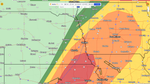
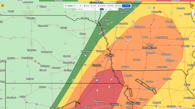
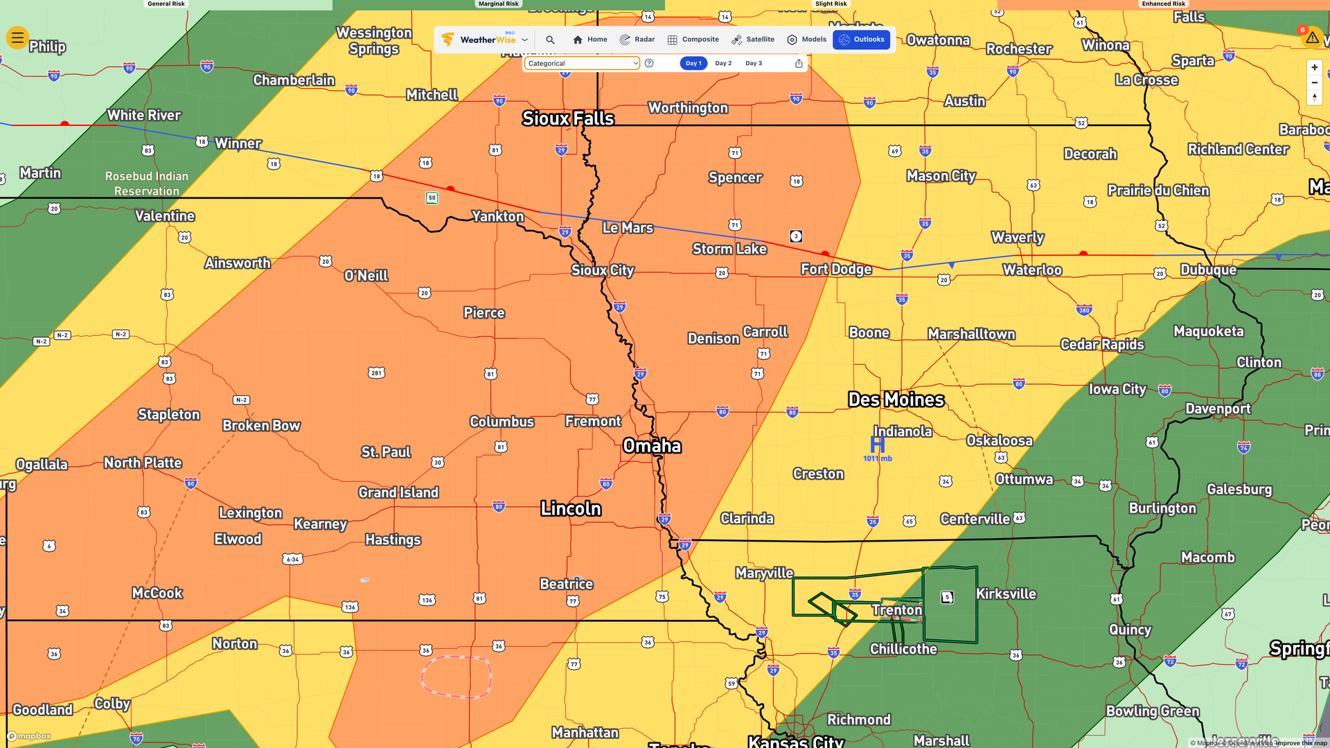
This Afternoon — Pay Attention
Storms come back, probably around 4 PM, maybe a little earlier. They fire up northwest of a Lincoln-to-Harlan line first. This is the setup forecasters have been watching all weekend, as the atmosphere has been recharging all morning and by afternoon it’s coiled tight.
When these storms develop, they’re expected to organize fast into supercells. That’s the kind of rotating thunderstorm that produces all three: very large hail, damaging winds, and tornadoes. Possibly strong ones. The forecasters are tracking whether storms stay isolated or merge into a line, because isolated supercells are the more dangerous scenario for tornadoes. Right now the setup favors isolated.
Two things I’m seeing in both of the main models are high levels of CAPE (think of this as kindling for a thunderstorm) and higher dew points in the upper 60s, maybe low 70s. Both of these are showing a significant drop off behind it as everything moves through, signifying a dry line, which will probably be the launch point to all of this. There’s also going to be a lot of wind shear, especially at the lower levels. This is the birds and the bees of tornado baby-making. The only disparity is in the timing of this, as one model is showing things blowing up starting around 4 p.m. and the other a couple of hours later.
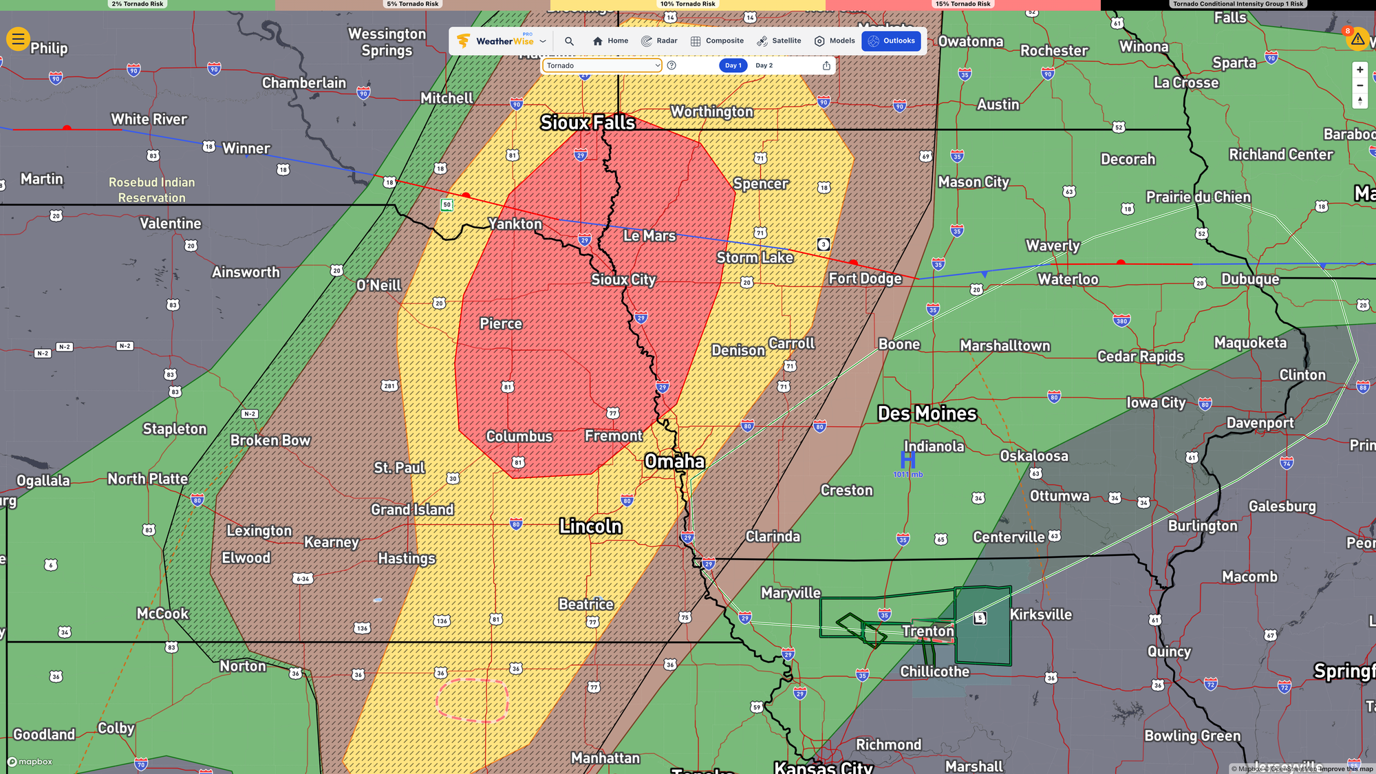
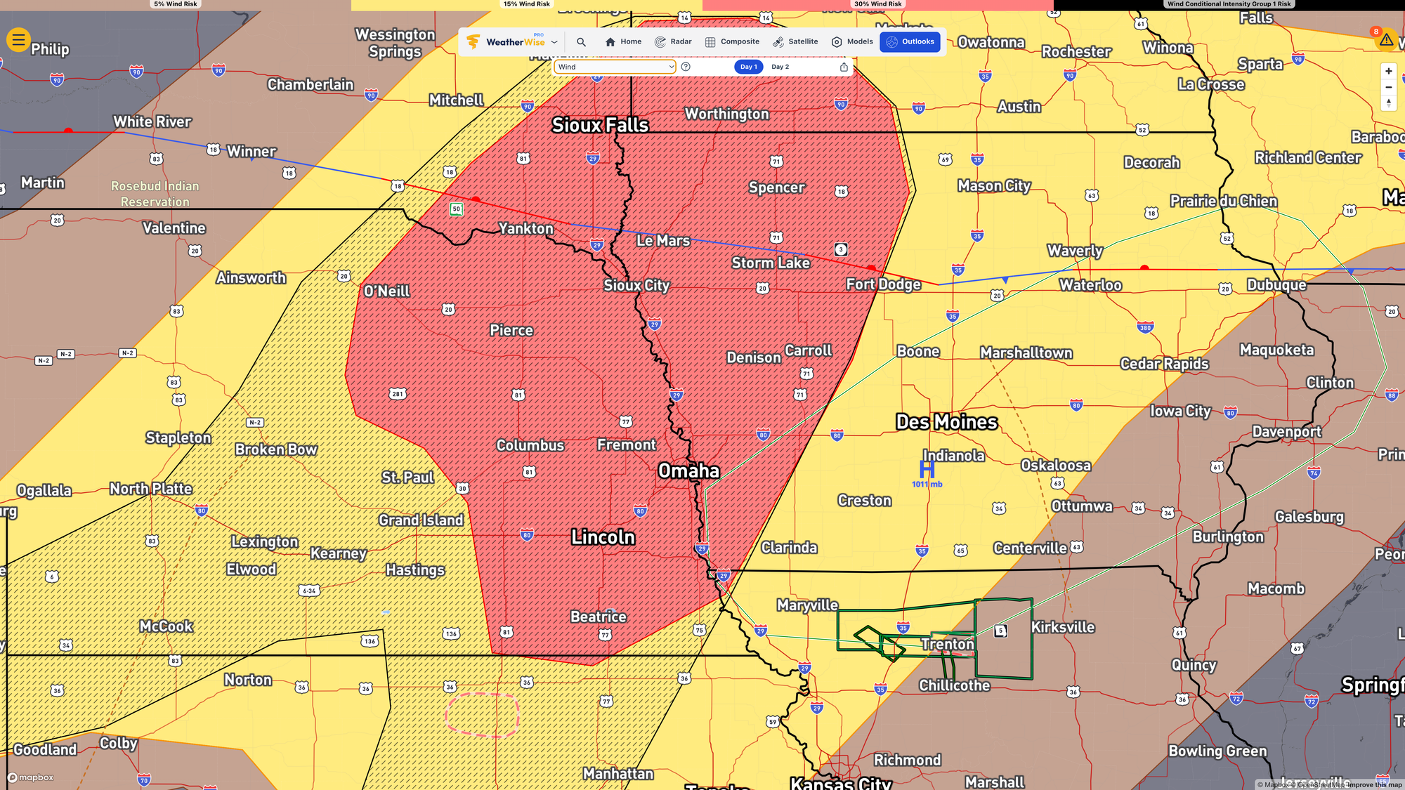
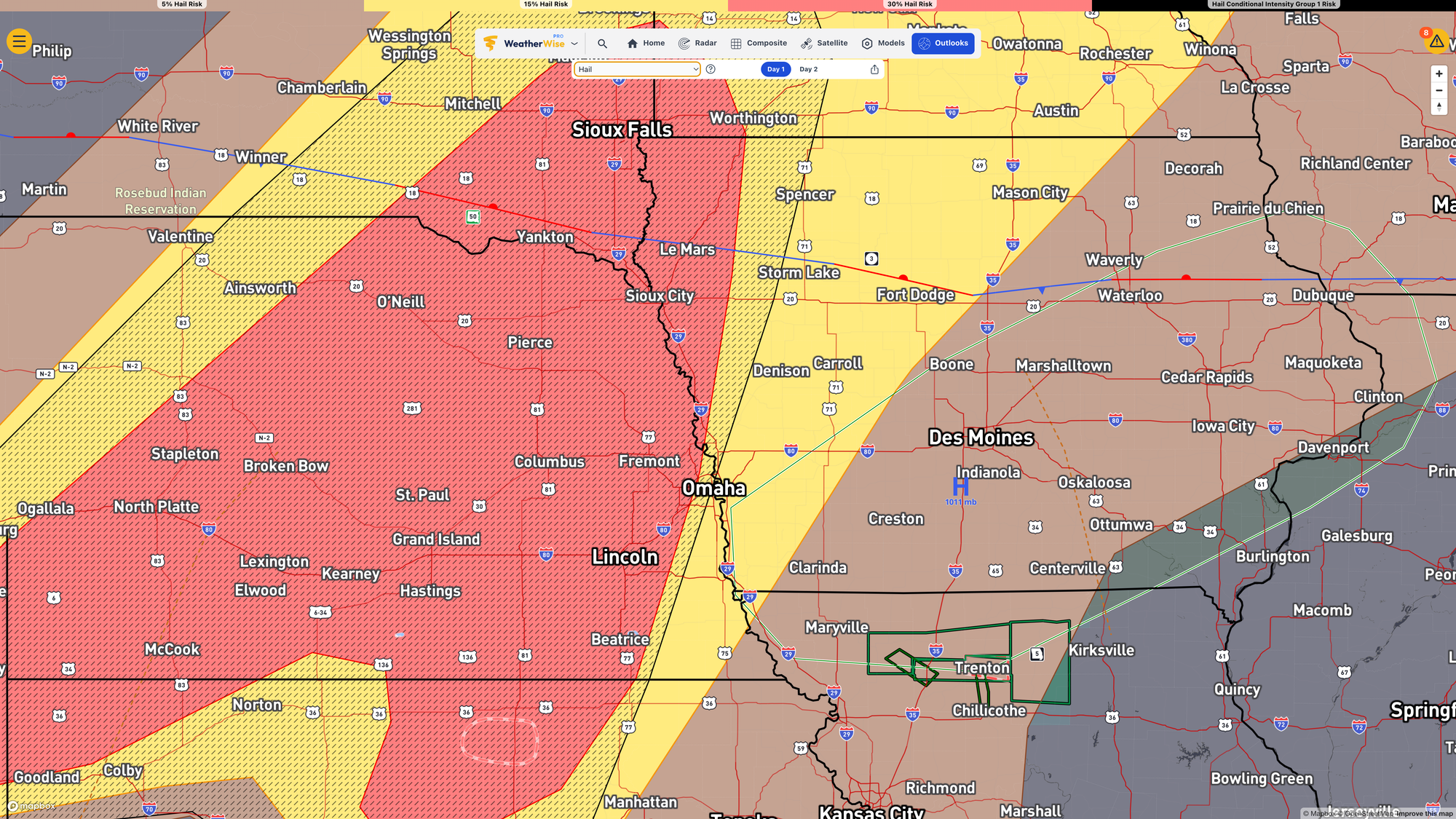
The tornado, wind, and hail threats for today. Hashmarks indicate an elevated chance for bigger weather. You don't want to be in the red area. Images are clickable for better viewing.
Monday — One More Round
Same deal, different placement. Monday’s threat sets up southeast of a Seward-to-Onawa line. All the same hazards on the table. Forecasters are still sorting out exactly where the worst of it lands and say they probably won’t know with confidence until Monday morning.
After That
Sharp cooldown. Highs drop into the 50s and 60s midweek, with frost possible some mornings.
The short version: Sunday afternoon is the window to take seriously. Alerts on, know your plan, check back as the day develops.