Severe Weather Update for Monday 18 May 2026

Here’s the overnight update for the Omaha-Lincoln area in plain language:
Here we go again!
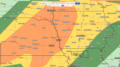
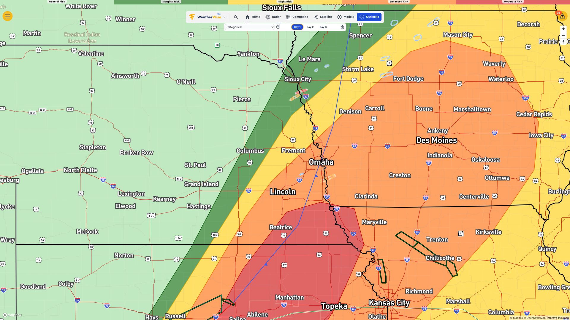
Monday afternoon, storms fire back up between 2 and 4 PM. Same setup as today. Supercells, large hail, damaging winds, strong tornadoes all on the table. Forecasters are watching where the cold front stalls, because that determines exactly where the worst of it sets up. They don’t have that pinned down yet.
Then around 8 or 9 PM, a second line of storms develops over the western counties and pushes through. This one’s a little different in nature but could still bring hail and damaging winds. That clears by midnight and that’s it. The multi-day severe weather stretch is finally over.
I’ll check things around noon to see where we sit, as that’s when the SPC gives their afternoon update.
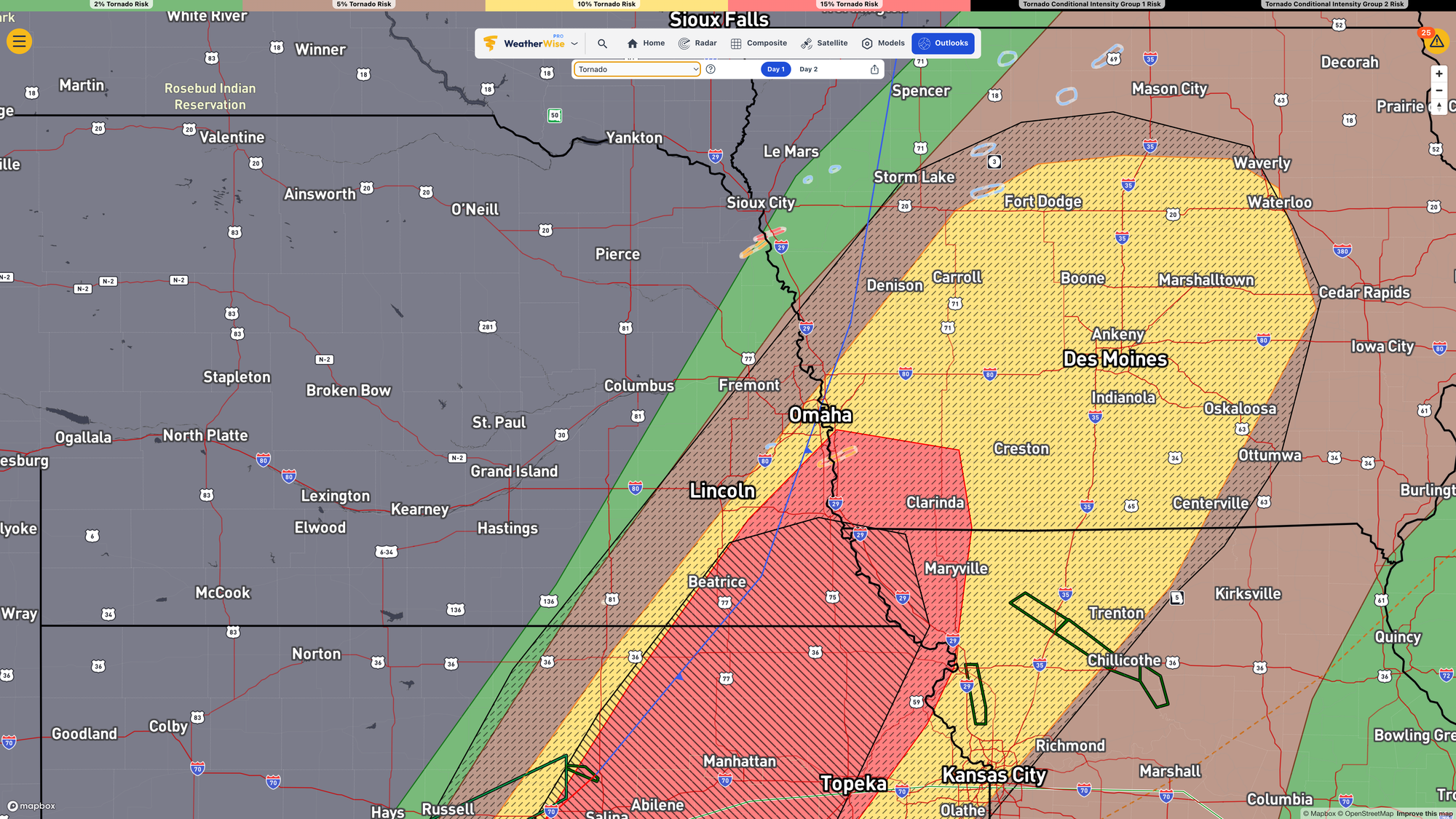
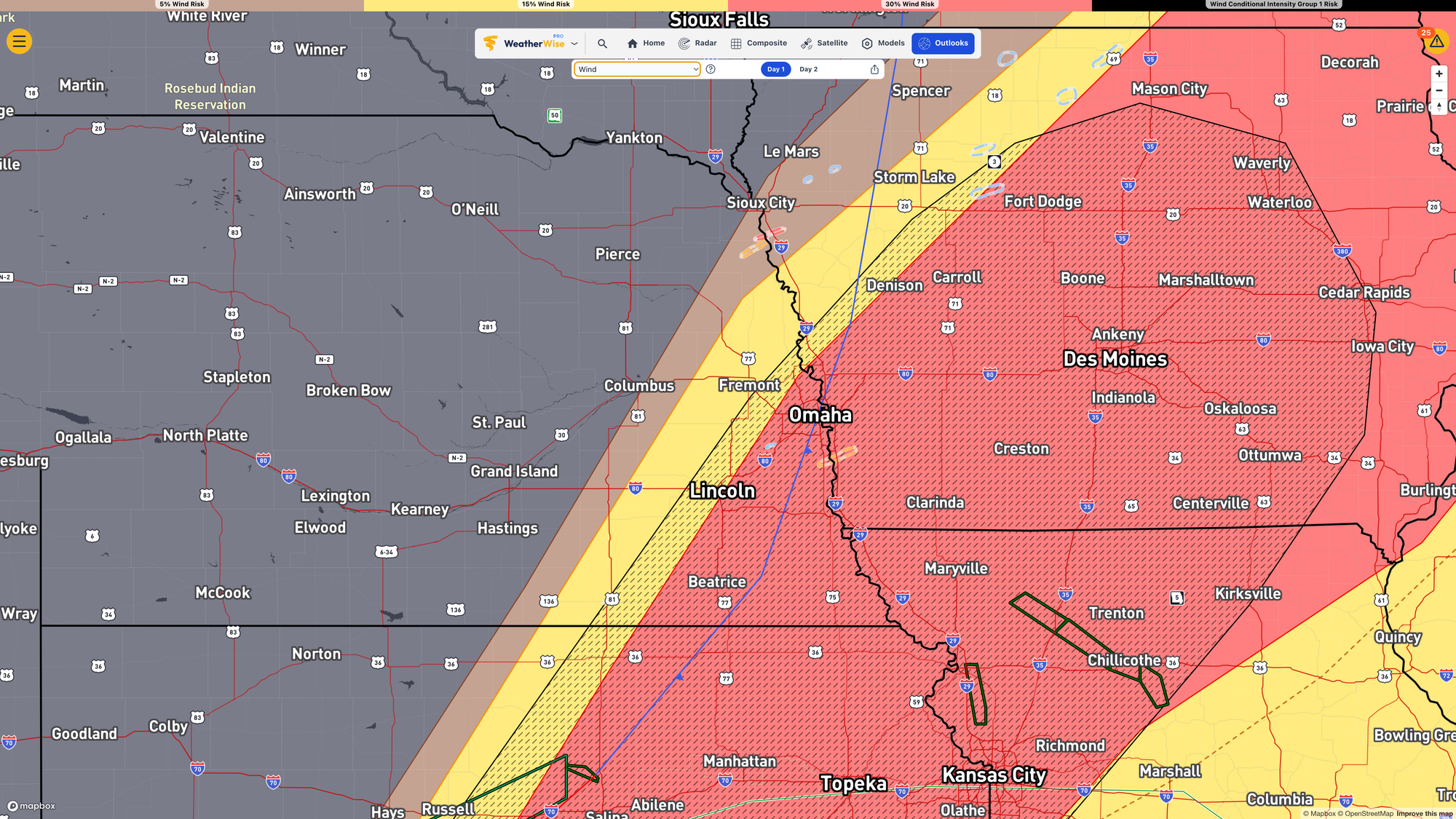
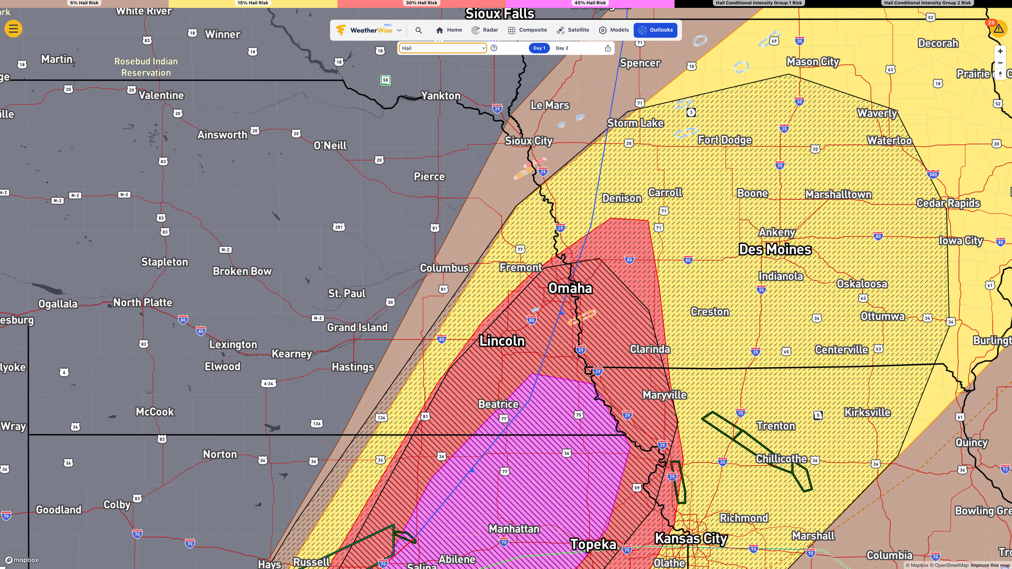
The tornado, wind, and hail threats for today. Hatch marks indicate larger types of these events are possible. Images are clickable.
Tuesday is the reset. Cooler Canadian air moves in, skies clear out by afternoon, highs only in the upper 50s to mid 60s. Feels like a different planet after this weekend.
Wednesday morning, frost is possible, especially northeast Nebraska. Lows dropping into the mid 30s up there.
Next weekend they’re already watching another system. No details yet, but the pattern doesn’t look like it’s settling down for long.
One more day. Then you can exhale.